How Montana tribes are using sovereignty to restore their waterways
‘We live at the backbone of the world, where the water begins.’
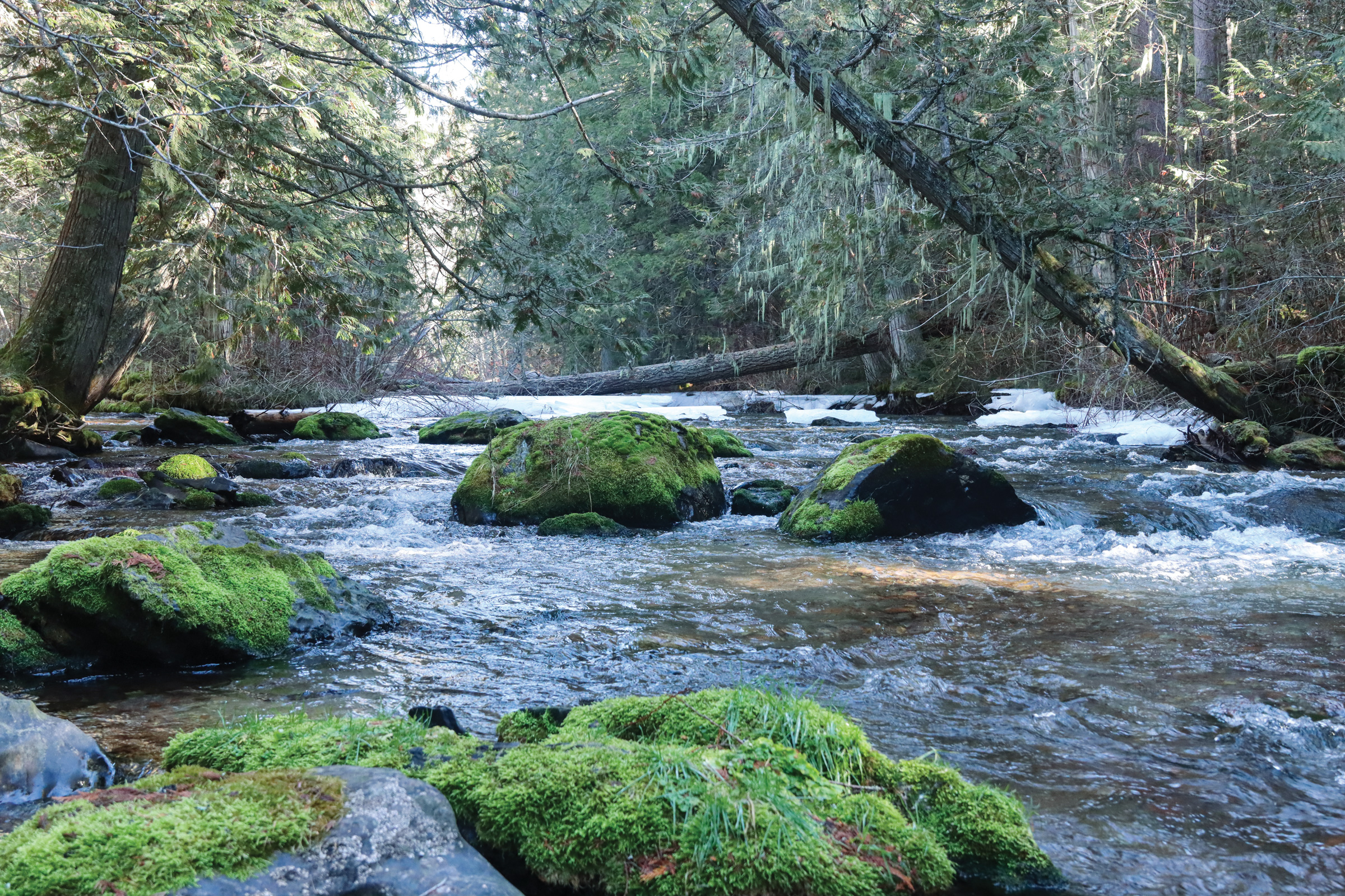
The Jocko River at the confluence of its south and middle forks. Liz Dempsey/High Country News
High Country News | March 9, 2026
By Emily Senkosky
Under the subdued gray light of the winter sun, Germaine White, enrolled member of the Confederated Salish and Kootenai Tribes (CSKT), reminisced about the Jocko River slowly meandering in the shadow of the Mission Mountains in Northwestern Montana. Once, the river —nisisutetkʷ ntx̣ʷe in the Séliš-Ql̓ispé language — was laden with bull trout, and its plentiful tributaries provided abundant fresh cold water every spring.
“We live at the backbone of the world, where the water begins,” said White. “Scientists call it a ‘resource,’ but we call it the source.”
The Jocko River is fundamental to CSKT life, but over the last century the watershed became disconnected from its floodplain, leveled and channelized when agriculture moved onto the Flathead Indian Reservation. After a decade of negotiations, however, one of the most significant tribal settlements in U.S. history created the 2015 Confederated Salish and Kootenai-Montana Compact Water Rights Compact. Effective in 2021, the compact reauthorizes tribal water rights promised in the 1855 Hellgate Treaty, while also protecting existing water users through a joint state-tribal water management system. The combination of Indigenous-led restoration, shared management structures and targeted funding may help the tribe recover the rivers and the lifeways inextricably intertwined with them.
THE ABORIGINAL TERRITORY of the Selis, Ksanka and Qlispe tribes covered 22 million acres of western Montana and extended into Canada, Idaho and Wyoming. The three tribes coexisted in a rich landscape, amid over 980 miles of rivers and streams — a natural abundance that explains why Salish elder Mitch Smallsalmon famously called the tribes “wealthy from the water.”
But the tribes lost some of that wealth when the 1855 Hellgate Treaty was signed. And in 1887, the Dawes Act, determined to assimilate Indigenous people into settler society, opened parcels of the CSKT reservation to homesteaders. Even though the reservation comprised only about one-twentieth of the tribe’s original homeland, the act further divided the landscape, creating a patchwork of private and tribal lands. Many of the place names around the Mission Valley were lost, replaced by the settlers’ versions.